HighwayScene · Static Roadside LiDAR

Beam-Wise Statistical Background Subtraction for Static Roadside LiDAR: A Cross-Sensor Benchmark Study

Alexander Baumann1 Marcel Voßhans1 Thao Dang1

1 Institute for Intelligent Systems, Esslingen University of Applied Sciences, Germany

Accepted at the 29th IEEE International Conference on Intelligent Transportation Systems (ITSC 2026)

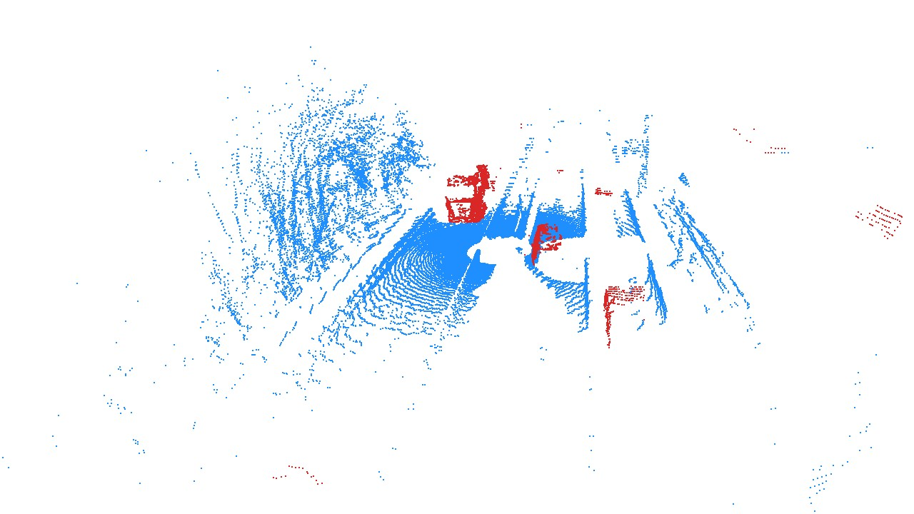
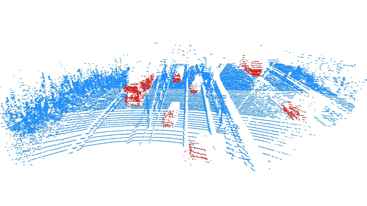
Synchronized HighwayScene observations from three roadside LiDAR technologies.
Synchronized HighwayScene observations from the Ouster OS0, AEVA Aeries II, and Blickfeld QB2. Dynamic foreground points are shown in red.
3LiDAR technologies
5,998HighwayScene records
5evaluated scenes
>90%best filtered F1 per scene

Overview

Background subtraction without semantic training labels

We study statistical background subtraction for statically mounted roadside LiDAR. The methods learn the range behavior of each beam from an unlabeled recording and identify points that are inconsistent with the learned static background during inference.

The benchmark combines HighwayScene—a synchronized recording from solid-state, rotating time-of-flight, and FMCW LiDAR—with four urban CoopScenes sequences. It compares four beam-wise model families and spatial consistency filters under a shared evaluation protocol.

New multi-LiDAR dataset

A synchronized static highway scene recorded with three complementary sensing technologies.

Four model families

Density-aware CFTA, quantile-constrained Gaussian, beam-wise GMM, and image-based MOG2.

Reproducible benchmark

Released configurations, reference results, dataset adapters, and extensible method interfaces.

Method

Beam-wise modeling at a glance

The approach assumes a fixed, known scan pattern and a temporally stable static background. Training requires only a short unlabeled point-cloud sequence.

1 Observe Collect 600 static-sensor frames.
2 Model Fit independent range statistics per beam.
3 Predict Classify points against the learned background.
4 Filter Enforce spatial consistency in angular or 3D space.

Dataset

HighwayScene

A synchronized multi-LiDAR recording from a static roadside installation at a highway construction site.

Annotated point cloud from the Blickfeld QB2 solid-state LiDAR.
Blickfeld QB2
Solid-state LiDAR · 5 Hz
Annotated point cloud from the Ouster OS0 rotating time-of-flight LiDAR.
Ouster OS0
Rotating time-of-flight LiDAR · 10 Hz
Annotated point cloud from the AEVA Aeries II FMCW LiDAR.
AEVA Aeries II
FMCW LiDAR · 10 Hz

One scene, three sensing principles

All sensors observe the same traffic scene from a fixed roadside position. The published split contains 4,000 training, 1,000 validation, and 998 test records. Dynamic references are derived from lane-aligned 3D regions for the Ouster and Blickfeld streams and radial velocity for the FMCW stream.

Recording rate
10 Hz; Blickfeld 5 Hz
Paper range
100 m
Traffic setting
Highway construction zone
Evaluation
Point-wise static/dynamic labels

Results

Strong performance across sensor technologies

Spatial filtering substantially improves precision. On HighwayScene, beam-wise GMM achieves the highest filtered F1 score for all three sensors; density-aware CFTA is the most consistent method across the full cross-dataset benchmark.

Ouster OS0 99.43 filtered F1 · GMM
Blickfeld QB2 96.95 filtered F1 · GMM
AEVA Aeries II 97.59 filtered F1 · GMM

Values are the best filtered F1 scores on the HighwayScene test split. The benchmark additionally evaluates transfer to four urban CoopScenes sequences.

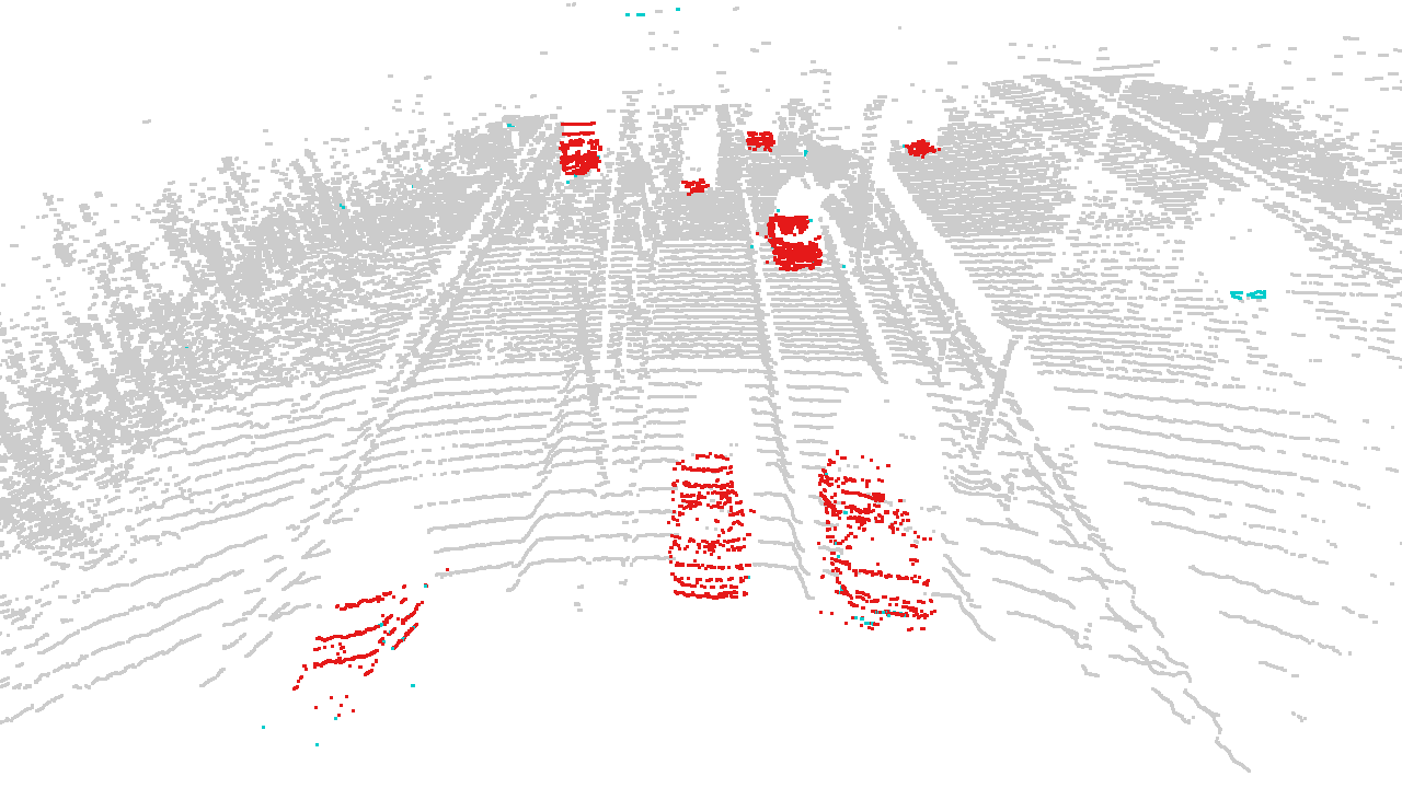
Qualitative HighwayScene FMCW background subtraction result.
HighwayScene
Qualitative FMCW result
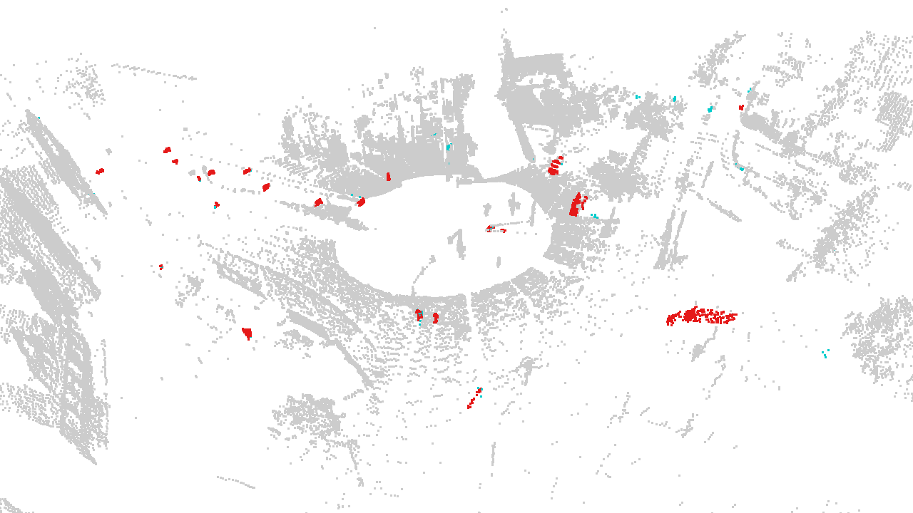
Qualitative CoopScenes background subtraction result.
CoopScenes
Qualitative urban transfer result

Resources

Paper, code, and data

Paper

Accepted at IEEE ITSC 2026.

arXiv link coming soon

Method code

Reproduction configs and extensible Python implementation.

Coming soon

HighwayScene dataset

Point clouds, synchronized splits, and dataset documentation.

View on Hugging Face

HighwayScene reader

Typed Python bindings and streaming access for the released Protobuf records.

highwayscene-proto

CoopScenes labels

Static/dynamic point-wise labels added to the original CoopScenes dataset.

Direct dataset link coming soon

Citation

BibTeX will be added with the final proceedings metadata.